
Maps
Maps are a wonderful and essential tool for the study of history, as they are time capsules that take us well beyond place names and geography to moments in time. Depending on the purpose of the map, it might reveal what was deemed important to the cartographer, who lived where, what businesses were prominent, what natural features were worth noting. North Salem has an excellent collection of maps – some copies, some originals – dating from the 17th century, through the American Revolution and on up to the present. Here are a few samples. Please be aware that the images may be copyrighted and should not be reproduced without permission from the owners.
During the Revolutionary War, some families and even households were divided between Loyalists and Patriots. Abraham Close, who lived near today’s Christmas tree, was a Loyalist who drew maps for the British after he left town. Close identified his own home by name, probably for protection of his property should the British decide to occupy or burn North Salem.
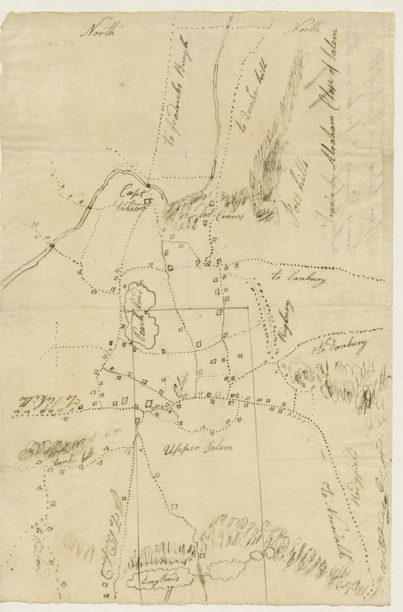
Abraham Close Map of Upper Salem 1776. (27.4 cm x 10.79) The originals of the Close maps are in
the papers of Major General Henry Clinton at the William L. Clements Library, Ann Arbor, MI.
Also during the Revolutionary War, Rochambeau’s aide and cartographer Alexandre Bertier drew maps of all of the army’s camps. This one shows the 39th camp at Salem on the return march from the victory at Yorktown. Some maps were still drawn then with North on the left. Delancey Hall, today’s Town Hall, is below the e in Salem.
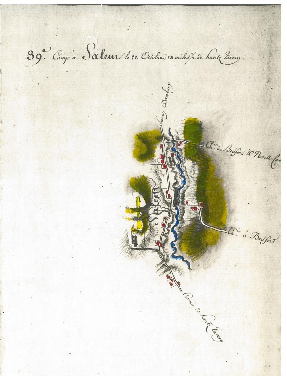
The originals of Bertier’s maps and narrative descriptions of the French Army’s American Campaigns are in the Princeton Library and are
reproduced in the book The American Campaigns of Rochambeau’s Army – 1780-1783, translated and edited by Howard Rice and Anne Brown.
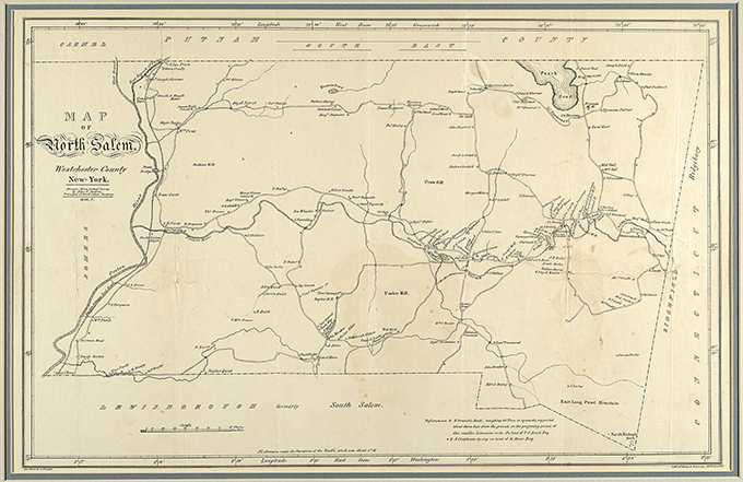
In 1846-47, Principal of the North Salem Academy John Jenkins created two editions of a surveyed map of the town, the first map to include the names of most property owners. The railroad had just come to town, and Jenkins identifies the two depots. He also wrote a note at the bottom of the map about Balanced Rock.
Maps are often works of art as well as conveyors of information. This Map of a Farm (1855) belonging to Elizabeth Delancey, niece of Stephen Delancey, shows the properties leased to her tenants. North is to the left, and that border is Hardscrabble Road; the bottom edge is Delancey Road. The property is the same land that became the North Salem Vineyard in the 20th century and is now private property.
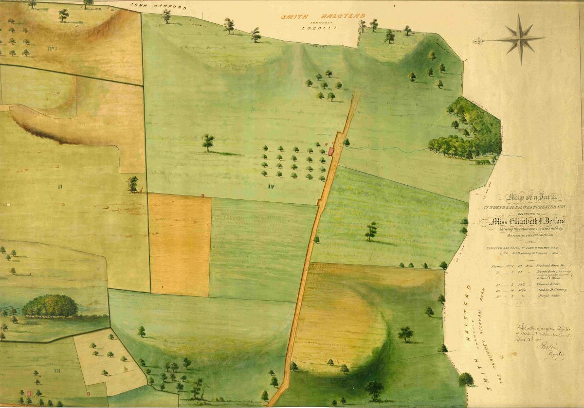
The original, 24 X 36, is the property of the Westchester County Archives, County Clerk’s Map # 637
It was hand drawn and surveyed by John B. Holmes
By 1930, maps of the town not only named property owners but also showed the boundaries of their land. But be forewarned: mapmakers often copied each other and didn’t always do original research. The only way to be sure who owned a property is through deed research.
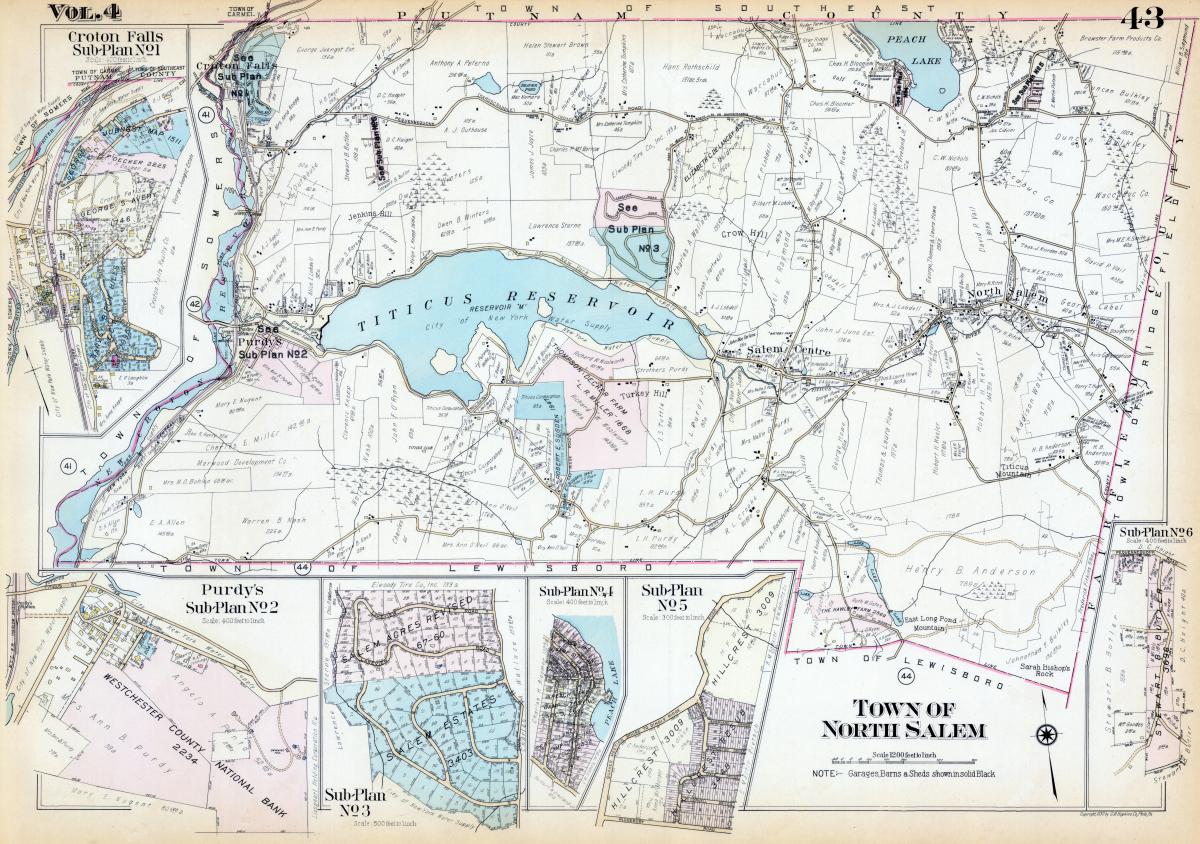
This map is from the G.M. Hopkins Company Atlas of Westchester County 1930. Elizabeth Delancey’s name is still on the property from the previous map, even though there is a new owner.
Make an appointment to come by the Town Historian’s office to see more maps!